

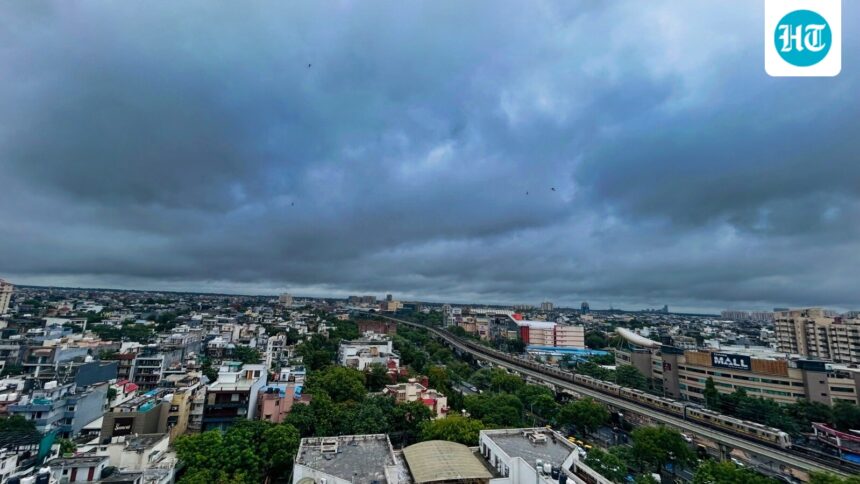
As of Thursday afternoon, boats were on the streets in Ghaziabad’s Vasundhara, clouds were covering high-rise buildings in Noida, and traffic jams were common in Gurugram and New Delhi.

East Delhi, Noida, Ghaziabad and Faridabad bore the brunt of heavy rain from Wednesday night until morning, while west and central Delhi and Gurugram saw lighter rain, meteorologists said.
Ask why, and the same two words will come up: low pressure.
“Monsoon has finally gained strength in Delhi-NCR… Due to the influence of active low pressure area and monsoon trough, there is a possibility of intermittent rains continuing till July 10,” private weather company Skymet Weather said in X.
Low pressure and monsoon trough are terms that appear every year during the rainy season. HT explains what it means, why it rains, why it might stop – and then it starts.
Read also: Rain fury in Delhi – NCR: A car in a ditch, clouds swallow high-rise buildings, severely waterlogging them
What is a low pressure area?
A low pressure area is a patch of the atmosphere where surface air pressure drops below its surroundings. When this happens, air in the relatively higher pressure area rushes around it to fill the gap.
In the Northern Hemisphere, the flowing air flows in a counterclockwise direction, converging toward the center of the depression, with nowhere to go but up.
This upward movement is where the story lies. Rising air cools as it rises. Cold air retains less moisture than warm air, so the water vapor it carries condenses into cloud droplets and, with enough of them, leads to precipitation.
The India Meteorological Department (IMD) explains this “depression” as “associated with vortex movement of air, convergence and upward movement of air. In the depression, clouds and rain are usually found.”
Monsoon rain usually begins by pushing air upwards somewhere. The low pressure area is where this lift is seen. It can spread over hundreds of kilometers and last from hours to days.
As the low intensifies — its winds pick up to more than 17 knots — the IMD reclassifies it, first as a “well-defined” low and then as a depression, with each step reflecting stronger convergence and, usually, heavier rain.
The IMD bulletin at 9:15 am on Wednesday identified a well-defined low pressure area over northeastern Madhya Pradesh and neighboring southeastern Uttar Pradesh, through which the monsoon low passes from southwest Rajasthan to Bangladesh. Since then, the system has come close enough to the Delhi-National Capital Region (NCR) to feed rainfall on Thursday.
Read also: Work from home advisory in Gurugram after heavy rain led to closure of roads and highways
Monsoon basin
During the monsoon months, a long belt of low pressure – called a monsoon trough – typically extends from a heat-induced low over Pakistan to the head of the Bay of Bengal, roughly tracing the Gangetic Plain.
Think of it as the backbone of the monsoon: a line of low pressure running across the Indian subcontinent, along which smaller weather systems — from regular lows to full-blown monsoon lows — form and move west.
The IMD describes it as “one of the semi-permanent features of the monsoon cycle” and suggests that its shape “may be a feature” of the east-west track of the Himalayas and the north-south trend of the Khasi Jaintia Hills in Meghalaya.
The trough is unstable. Its eastern end could drift as much as five degrees of latitude north or south within a day, according to the IMD.
The location of the basin determines the areas where rainfall falls. As it pulls south from its usual location, it draws a belt of heavy rain over central and northern India, including Delhi and the National Capital Region (NCR).
Pushed northward into the foothills of the Himalayas, the plains dry up in what forecasters call a “break” in the monsoon, with even the hills and the Brahmaputra Basin submerged instead.
“The northward migration of this basin results in breaking monsoon conditions over large parts of India, heavy rains along the foothills of the Himalayas, and sometimes flash floods in the Brahmaputra River,” says the IMD.
Thursday’s rain, as calculated by Skymet Weather, is the trough that suits Delhi, enhanced by the low pressure system running along it. This well-marked low-system over MP fits the IMD description of systems riding the trough: “Monsoon lows and troughs are the main rain-bearing systems in the southwest monsoon period over India.”