

Most bridges are forgotten once they are crossed. A few seconds above the river, a quick glance out the window, and the journey continues. The longest bridges in the United States belong to a completely different category.
These are structures that stretch for miles across open water, wetlands and vast coastal landscapes, where the road appears disconnected from the surrounding land. In many cases, drivers spend so much time on the bridge that the shoreline disappears from view completely. It’s no surprise that Louisiana dominates the rankings. The state’s geography is a patchwork of bays, swamps, and swamps that leave engineers no choice but to build roads over water.
Together, these bridges tell a story not only about transportation but also about the landscape that made them essential.As WorldAtlas notes, some of the longest bridges in the United States are much more than simple river crossings. These vast structures stretch across lakes, bays, marshes and coastal wetlands, carrying motorists for miles over landscapes where conventional roads would be difficult, if not impossible, to build.
Louisiana dominates the rankings thanks to its extensive network of swamps and waterways, with many of the country’s longest bridges located within the state.
Check out below the 10 longest bridges in America.
The longest bridges in America : 10 of Longest bridge crossings From the Lake Pontchartrain Bridge to the San Mateo-Hayward Bridge
| Rank | Bridge | length |
| 1 | Lake Pontchartrain Bridge | 23.83 miles (38.35 km) |
| 2 | Manchac Swamp Bridge | 22.8 miles (36.7 km) |
| 3 | Louisiana Memorial Airborne Bridge (Atchafalaya Basin Bridge) | 18.2 miles (29.29 km) |
| 4 | Chesapeake Bay Bridge Tunnel | 17.6 mi (28.32 km) |
| 5 | Bonnet Carré Spillway Bridge | 11 miles (17.7 km) |
| 6 | Louisiana Highway 1 Bridge | 8.26 mi (13.29 km) |
| 7 | Jubilee Parkway | 7.5 miles (12.1 km) |
| 8 | San Mateo-Hayward Bridge | 7 miles (11.27 km) |
| 9 | Seven Mile Bridge | 6.79 mi (10.78 km) |
| 10 | General W. K. Wilson Jr. Bridge | 6.08 mi (9.78 km) |
Longest bridges in the United States ranked From Chesapeake Bay to Lake Pontchartrain
Lake Pontchartrain Bridge
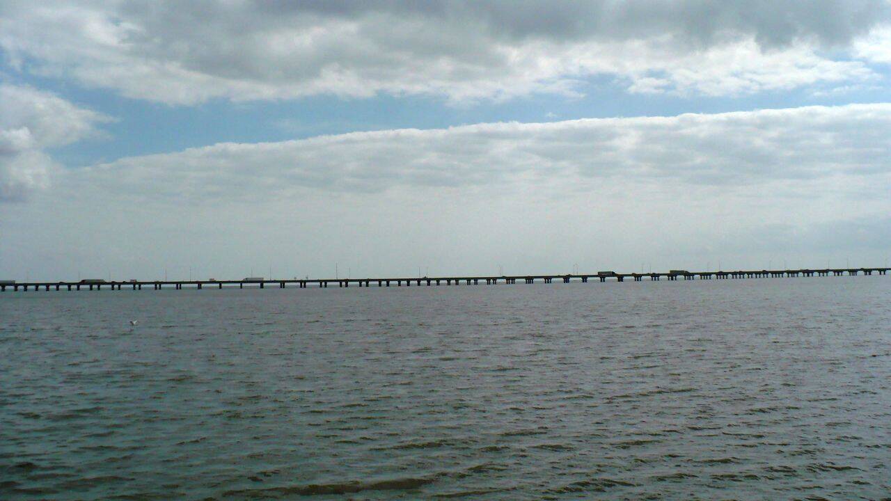
There is nothing else in the country as large as the Lake Pontchartrain Bridge. It extends approximately 24 miles across the broad waters of Lake Pontchartrain, connecting the communities of Mandeville and Metairie on both sides of the lake.During most crossings, drivers are surrounded by water with no sense of how far they have traveled or how much distance remains in front of them. The first bridge entered service during the 1950s, while the second parallel bridge arrived more than a decade later to accommodate increased traffic. The structure became internationally recognized through its long-standing record as the longest continuous bridge over water in the world, a distinction it still holds in its specific class.
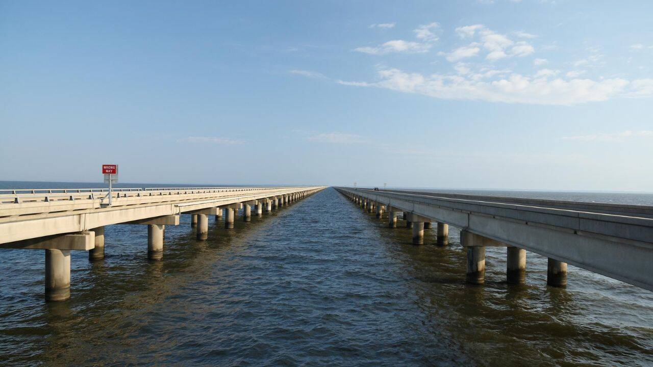
Manchac Swamp Bridge
Just a short distance behind the bridge is the Munchuck Swamp Bridge, another Louisiana giant. Interstate 55 carries through a massive swamp system, extending nearly 23 miles through a landscape of cypress trees, trails, and swamps.The bridge forms a large part of the highway itself. Travelers heading between New Orleans and Jackson often cross it without realizing how high the road is above the wetlands.
Local folklore has attached many stories to the area over the years, giving the crossing a reputation that extends beyond engineering and transportation.
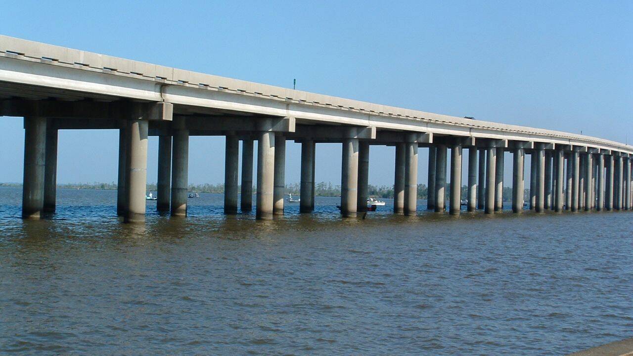
Louisiana Memorial Airborne Bridge
The Louisiana Memorial Airborne Bridge is known to most as the Atchafalaya Basin Bridge. It passes through the largest river swamp in the United States and forms an important section of Interstate 10 between Baton Rouge and Lafayette.Driving through it offers a changing view of waterways, forests and floodplains.
Rather than a single, uninterrupted structure, parts of the crossing consist of parallel stretches that come together at key points along the way. Since its opening in the early 1970s, it has become one of the most widely used long bridges in the country.
Chesapeake Bay Bridge Tunnel

Computer: official website
The Chesapeake Bay Bridge-Tunnel in Virginia is in a class of its own. Unlike most bridges on this list, it combines elevated roads with parts of submerged tunnels.The road crosses the mouth of the Chesapeake Bay and provides a direct connection between the eastern shore of Virginia and the Hampton Roads area. At certain points, motorists leave the bridge and go underwater before resurfacing on another elevated section. This arrangement allows large ships to move freely through shipping channels while maintaining a continuous road link. The result looks less like a bridge and more like a collection of carefully stitched geometric solutions.
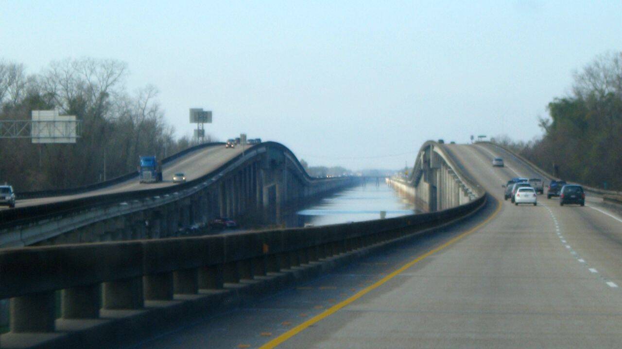
Bonnet Carré Spillway Bridge
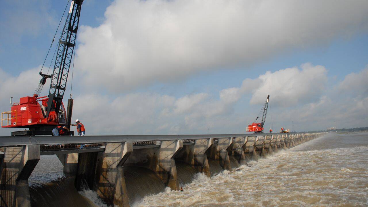
Interstate 10 appears frequently in Louisiana’s network of long-distance bridges, the Bonnet Carré Spillway Bridge being another example. This route extends approximately 11 miles, passing over wetlands, flood control infrastructure and parts of the western edge of Lake Pontchartrain.Its location is closely linked to the Mississippi River. During periods of exceptionally high water, a spillway below can divert excess river flow toward the lake, helping to reduce flood risks elsewhere.
The bridge is located over one of the most important flood management systems in the region.
Louisiana Highway 1 Bridge

PC: http
To the south, the Louisiana Highway 1 Bridge carries traffic toward Port Fourchon, one of the Gulf Coast’s major industrial centers. The elevated road was developed in part because the low-lying roads it replaced faced constant flooding and subsidence.The crossing rises over swamps and waterways for more than eight miles.
In a country where coastal erosion remains an ongoing concern, infrastructure often needs to adapt to the changing landscape. This bridge reflects this fact perhaps more clearly than any other.
Jubilee Parkway
The first appearance outside of Louisiana comes in neighboring Alabama. Jubilee Parkway runs through Mobile Bay and forms part of Interstate 10’s route through the area.Residents usually refer to it simply as the Bayway. The bridge has become a daily feature for travelers traveling between Mobile and the communities on the eastern side of the bay.
Its official name comes from a local natural event known as a “Jubilee”when marine life congregates unusually close to shore under specific environmental conditions.
San Mateo-Hayward Bridge
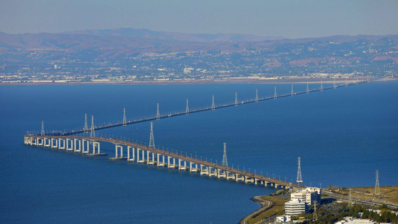
The longest bridge in California is located across San Francisco Bay. The San Mateo-Hayward Bridge creates a direct connection between the East Bay and the San Francisco Peninsula, carrying thousands of vehicles daily across nearly seven miles of water.Much of the structure remains low and close to the surface of the bay.
Then, suddenly, the road climbs to a higher section that allows ships to pass underneath. This shift in elevation breaks up what would otherwise be a remarkably flat crossing and provides expansive views across the surrounding coast.
Seven Mile Bridge
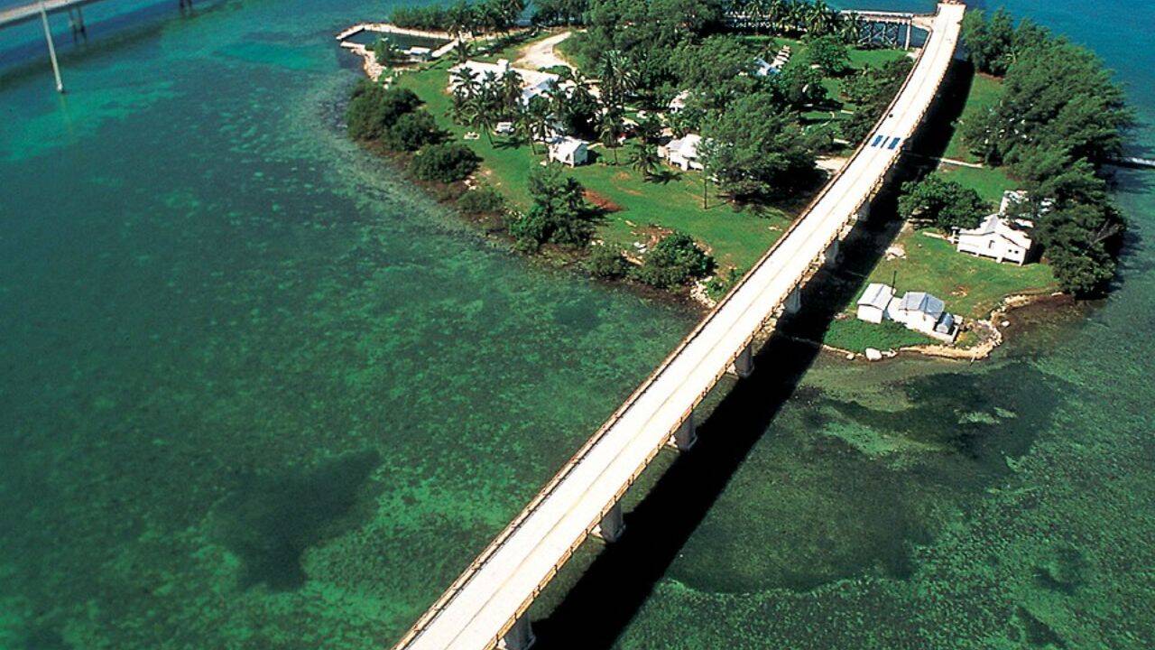
Despite its famous name, the Seven Mile Bridge does not span a full seven miles. It remains one of the most iconic road bridges in the United States and a distinctive feature of the Florida Keys.The modern bridge was opened during the 1980s, replacing the old railway structure that still partially remains alongside it. Open water surrounds the road for most of the trip, creating one of the most unique driving experiences in North America. Film producers have long appreciated the place, and have used the bridge in many major productions over the years.
General W. K. Wilson Jr. Bridge
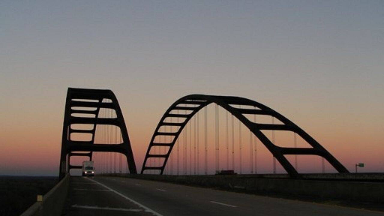
Back in Alabama, the General W. K. Wilson Jr. Bridge extends more than six miles across the Mobile-Tensaw Delta.
The area contains one of the largest wetland systems in the country, making elevated transportation routes a necessity.The double arch design stands out against the flat delta views. Although the bridge has an official name in honor of an engineer and military officer, many locals use an informal nickname inspired by the appearance of its double arches.