
After a wet start, July slid into a lack of rainfall. While the deficit this month may shrink, erasing the deficit in June remains more difficult

July is usually the wettest month of the southwest monsoon season from June to September. This makes it important to monitor the rainfall situation in this month, especially in the ongoing monsoon season, which has started off very dry. How has the July rain been so far? HT’s analysis of India Meteorological Department (IMD) rainfall grid data shows that the month, which started very wet, has now accumulated a deficit. Although replacing the deficit in July will not be difficult, erasing the deficit accumulated in June remains a difficult task.


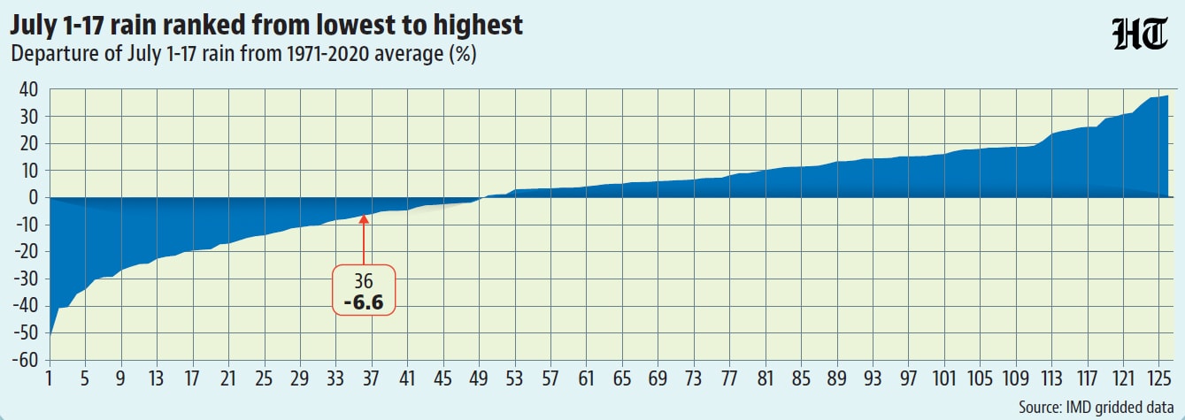
This is the 36th driest July since 1901, but the deficit is only 7%.
India received 137.6 mm of rain in July. This is the 36th lowest rainfall from July 1 to July 17 since 1901, the first year for which the IMD published gridded data. However, July rainfall is only about 7% below the 1971-2020 average, which the IMD currently uses as the long period average (LPA) to track rain performance. The reason July rains seem so dry compared to other years is that the period from July 1 to July 17 has seen an excess in 77 of the 126 years since 1901.
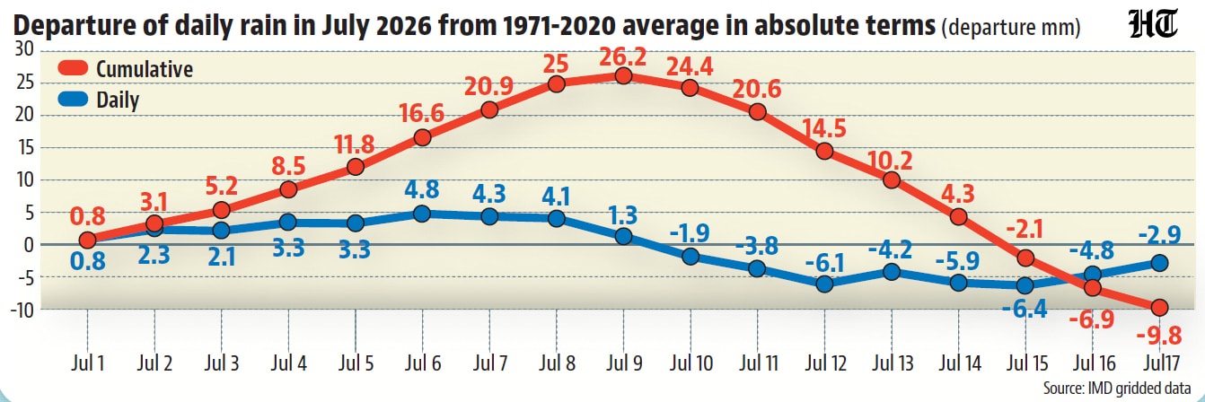
The July deficit can be made up quickly even with small daily surpluses.
The accumulated deficit of 7% so far in July amounts to only 9.8 mm. It shouldn’t be hard to make up for it if it rains like from July 1 to July 8. The first eight days of July were wet enough that July rains did not enter the deficit zone until July 15 — after six days of below-normal daily rainfall. At an average surplus such as July 1-8 (3.1 mm/day), July will enter the surplus zone in just over three days. Clearly, even a smaller daily surplus spread over a somewhat longer period should be enough to make up for last week’s drought.
But the total surplus is too large to be compensated for by a few days of surplus
The reversal of July’s recent turn to drought — expected next week — is important for at least one reason. It can help farmers who depend on rain for irrigation. However, July’s near-normal rainfall will not be enough to remove the cumulative deficit, which is important for recharging groundwater, reservoirs and other surface water sources. The cumulative rainfall this season is currently 251.7 mm, which is 19.8% or 62.1 mm less than the LPA. As the previous section’s calculations indicate, filling this deficit would require approximately 20 days of rain as the period from July 1 to 8.
The biggest problem is the geographical spread of rain
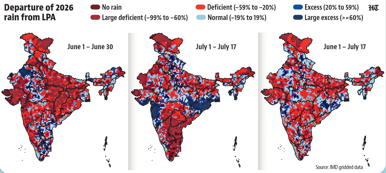
The large deficit in cumulative rainfall is certainly not the only problem facing the 2026 monsoon so far. It’s also geographically skewed in a weird way. The 57% of the country experiencing a significant deficit (20% or more, the threshold at which the IMD describes rainfall as “deficient”) in July is roughly the same as the 59% that is experiencing cumulative monsoon rainfall deficiency. What is the reason behind this geographical relationship? This is not difficult to see. The monsoon made slow progress during June and there was insufficient rain in the places where it reached. This means that July rains bear the burden of the general rainy situation in most places. Therefore, the missing places in July are also missing in general. To be sure, there are exceptions to this general trend. Parts of Tamil Nadu, Andhra Pradesh, Telangana, eastern Karnataka and western Rajasthan are in the normal or excess category (20% surplus or more) The cumulative rainfall condition is due to June rains and not July rains.