

Volcanoes have shaped some of the world’s most productive landscapes, leaving behind fertile soils, natural harbors and landscapes that have supported communities for centuries.
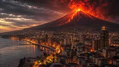
The same geological forces that enrich the Earth also create dangers that can return without warning. Around the world, millions of people still live beneath active volcanoes, accepting the risks because their homes, livelihoods and local economies remain closely linked to these landscapes. The WorldAtlas website lists cities that could face frequent ash falls, while others worry about lava, toxic gases or destructive mudflows that could travel several kilometers from the summit.Modern surveillance systems have improved early warning capabilities, but they are unable to eliminate the risk. These cities illustrate the delicate balance between opportunity and risk, and illustrate how communities have adapted their daily lives to some of the most active volcanic regions on Earth.
Cities built in the shadow of an active volcano
| city | nation | Nearby volcano | The main volcanic threat |
| Orting | US | Mount Rainier | Lahars (volcanic mudflows) |
| Tuttle | US | Mount St. Helens | Mudflows and volcanic deposits |
| Mammoth Lakes | US | Long Valley Caldera/Mammoth Mountain | Carbon dioxide emissions, earthquakes and possible explosions |
| Pahoa | US | Kiloya | Lava flows and fissure eruptions |
| Kagoshima | Japan | Sakurajima | Avalanches, explosive eruptions and volcanic rocks |
| Naples | Italy | Mount Vesuvius and Campi Flegrei | Lava flows, eruptions and widespread eruptions |
The most dangerous cities in the world built in the shadow of active volcanoes
Orting, Washington
Orting is located south of Seattle in a wide valley created by rivers flowing from Mount Rainier. The scene is quiet, with farmland spread across rich volcanic soil, but geologists know that the land beneath the city tells an older story.
Much of the community stands on sediment left by massive volcanic collapses that swept through the valley nearly five centuries ago.Unlike lava, lahar behaves like fast-moving, wet concrete. They can carry rocks, trees, and buildings over long distances while following river valleys. Mount Rainier has produced several such flows over the past several thousand years, and studies suggest another could eventually reach the Orting within an hour, leaving little time for evacuation.Because of this possibility, the city has developed one of the most comprehensive volcanic emergency programs in the country. Sirens are tested regularly, schools practice evacuation drills alongside fire drills, and clearly marked escape routes lead residents toward higher ground. The volcanic soil continues to support agriculture, which remains one of the reasons people continue to live here despite the long-recognized dangers.
Tuttle, Washington
The 1980 eruption of Mount St. Helens changed the landscape around Tootle more dramatically than almost anywhere else in the region. Entire forests disappeared under volcanic debris, bridges were destroyed and river channels were filled with ash and sediment carried downstream by powerful mudflows.The community is still living with what happened next. Every year, the rivers flowing into Mount St. Helens transport large amounts of volcanic material into the lower valleys.
To reduce the threat, engineers built a sediment detention structure, a specialized dam designed not to store water but to trap debris before it reaches populated areas.The structure has prevented huge amounts of sediment from moving farther downstream, and further improvements are planned to maintain its effectiveness. While Mount St. Helens remains closely monitored, surrounding communities continue to rely on both engineering projects and scientific monitoring to reduce future risks.
(Mammoth Lakes, California).
Mammoth Lakes occupies the edge of one of the largest active volcanic systems in North America. Beneath the ski resorts, forests and hot springs lies the Long Valley Caldera, formed hundreds of thousands of years ago after a massive eruption emptied a massive magma chamber.Although another eruption is not considered imminent, the volcanic system remains active. One of the most unusual dangers is invisible. Carbon dioxide naturally seeps through cracks in the ground, collecting in low-lying areas where it can displace oxygen.
In several parts of Mammoth Mountain, this gas killed large swaths of forest, leaving dead pine trees that remain visible decades later.Monitoring stations continuously measure gas emissions, ground movement, and earthquake activity. Buildings at vulnerable sites have been equipped with carbon dioxide detection systems, while scientists track small changes beneath the caldera that could indicate renewed volcanic unrest.
Pahoa, Hawaii
Life around Pahoa has been repeatedly shaped by Kīlauea, one of the world’s most active volcanoes. Instead of producing explosive volcanic eruptions, Kilauea often shoots lava through long fissures in the ground known as rift zones, allowing molten rock to emerge several kilometers from the summit.The eruption that began in 2018 transformed large parts of the surrounding area. The lava buried roads, destroyed hundreds of homes and permanently changed the coastline in several places.
Some neighborhoods disappeared under fresh volcanic rocks while others miraculously survived the advancing flows.Even after the eruption ended, volcanic activity continued elsewhere on Kilauea. Residents remain aware of hazard maps that divide the island into different areas at risk from lava, and property buyers routinely consider those maps before choosing where to live. The landscape continues to evolve as new eruptions periodically reshape the island.
Kagoshima, Japan
Daily life in Kagoshima unfolds under the watchful eye of Sakurajima, one of Japan’s most active volcanoes. Small eruptions occur so frequently that locals often treat drifting ash as part of normal life rather than as an unusual event.Ashfall affects everything from transportation to agriculture. The weather forecast includes forecasts showing where volcanic ash is expected to travel, helping residents prepare for changing conditions.
Municipal authorities distribute collection bags specially designed to dispose of ash, while regular cleaning of streets helps prevent ash accumulation.Schools have long adapted to the environment as well. During periods of increased volcanic activity, children may wear protective helmets outdoors due to the possibility of falling volcanic fragments. Despite these modifications, Kagoshima continues to thrive through its busy port, tourism and agriculture, where the volcanic soil supports crops such as tea, rice and the famous Sakurajima radish.
Naples, Italy
Few large cities live as close to active volcanic systems as Naples. Mount Vesuvius rises directly above the capital area, while the vast Campi Flegrei caldera stretches below the city’s western reaches. Together they put millions of residents within reach of future volcanic activity.The last time Vesuvius had a major eruption was during World War II, although the most famous event remains the eruption of 79 AD that buried Pompeii and Herculaneum under ash and volcanic debris.
Scientists consider another eruption inevitable at some point, even if there is no reliable way to predict Mo Exactly how many times it happened.Therefore, emergency planning has become part of daily management. Authorities are maintaining evacuation plans for hundreds of thousands of residents within designated danger zones, with transportation by road, rail and sea forming part of the strategy in case warning signs appear. The fertile volcanic landscape still supports vineyards and tomato plantations, while Naples itself remains one of the most important Mediterranean ports.
For many people, the advantages of living here outweigh the geological uncertainty of generations.

