

")
New satellite images provide aerial view of damage to Iran amid US-Israeli strikes (Image/X@FoxNews)
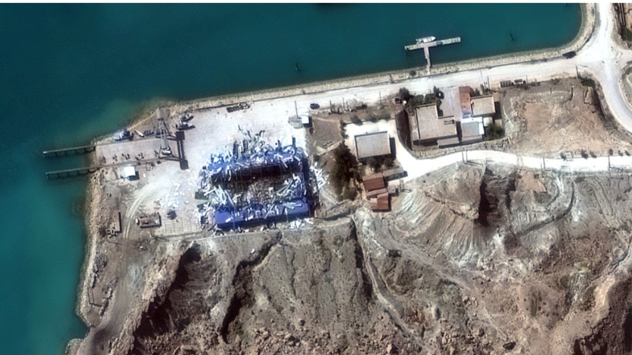
Recently released satellite images show an aerial view of extensive damage to the strategic Konarak base in southern Iran, as well as major damage to Tehran’s naval headquarters at Bandar Abbas on the Persian Gulf.The images, published by Planet Labs and the American spatial intelligence company Vantor, show precise strikes carried out by the United States and Israel. Satellite images captured burning ships and destroyed facilities, reflecting the scale of strikes on Iran’s military infrastructure.
Explosions rock Tel Aviv as Iran launches Khorramshahr and Fateh missiles in a new barrage
In addition to the naval assets, satellite images also show a bunker at Bushehr Air Base was attacked, leaving a large crater and destroying several small buildings nearby, according to Fox News.
Additional strikes targeted the Chuka Balak drone facility in western Iran. Radar systems were also hit at Zahedan Air Base in eastern Iran, located near the country’s borders with Pakistan and Afghanistan. The distance between the two facilities is about 800 to 900 miles.Satellite images also showed damage to planes parked on the runway at Shiraz Air Base, with visible burn marks and debris around several parking spaces.
Images taken by Planet Labs also show thick plumes of smoke rising over Tehran, indicating explosions and fires occurring within the Iranian capital. Al-Dukhan indicated that the conflict had extended beyond isolated military installations and into the heart of Iran’s political center.Satellite images also reveal damage to the coastal city of Sharjah in the United Arab Emirates, the country’s third most populous city after Dubai and Abu Dhabi. Jebel Ali Port, the largest maritime hub in the region, was also targeted, suggesting that retaliation extended beyond military installations to include key infrastructure.The newly released satellite images come after US-Israeli strikes that killed Iran’s Supreme Leader, Ayatollah Ali Khamenei, along with several senior members of the regime.US President Donald Trump warned on Sunday that Iran’s new leader Mojtaba Khamenei “won’t last long” without US approval, as Operation Epic Rage enters its third week.
